DEI/CISUC Seminars

September 11, Wednesday,
13h (sharp),
Room A.5.4 DEI-FCTUC
Invited Speaker: Gilles Falquet
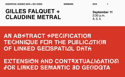
Title: "An Abstract Specification Technique for the Publication of Linked Geospatial Data"
Abstract: The publication of linked geodata on the semantic web may involve relatively complex operations to map source data to their published version and to link these ones to other datasets. In this paper we propose a technique to provide a compact and abstract description of this process. This technique is based on the use of RDF graph mapping rules that are expressed in the SPARQL Semantic web query language. We show that such rules are sufficient to express complex mapping and linking operations at a high level, without referring to operations specific to a particular vendor or tool. We also show how this technique applies to a non-trivial use case in the domain of tropical cyclones.
Short-bio: Gilles Falquet holds MSc and PhD degrees in Computer Sciences from the University of Geneva (Switzerland). He is currently an associate professor at the Computer Science Centre (CUI) of the University of Geneva. He is co-leading the Knowledge engineering research group at CUI. His research interests include: knowledge extraction and representation, knowledge visualization, and techniques to retrieve and access knowledge stored in texts, hypertexts, or other knowledge organisation systems. He has worked on the application of knowledge-based techniques in the fields of semantic digital libraries, information retrieval in scientific documents, the semantic enrichment of spatial data models, the management and visualisation of digital humanities data and geospatial data. His recent work in this field include methodologies and techniques for the integration and publication of geospatial data as linked data and the modelling of contexts (time, provenance, etc.) in geospatial knowledge graphs) He has co-authored numerous publications on these topics in books, journals or conference proceedings.
&
Invited Speaker: Claudine Metral
Title: "Extension and Contextualisation for Linked Semantic 3D Geodata"
Abstract: The application of the linked data principles provide a simple and effective way to publish and share data on the Web. The publication of geodata on the Web bas been studied and developed for a long time, leading to the creation of geo vocabularies and ontologies as well as geographic query languages. This is also true for 3D geodata, for which multiple RDF vocabularies and OWL ontologies exist (at the building, city, or territory level). In this paper we show that at least two issues remain to be addressed to reach a satisfactory publication framework for 3D linked geodata. First, the semantic model interconnection issue is not magically solved by the creation of ontologies, it requires the careful design of interconnection and extension schemes and their management. Second, the representation of additional dimensions, such as time, level of detail, confidence level, provenance, etc. cannot be directly handled in RDF. For these two issues we propose methodologies and design patterns and show how they can actually be used to create a semantically rich representation of 3D or nD linked geodata.
Short-bio: Claudine Métral is senior lecturer and researcher at University of Geneva, Switzerland. She belongs to the Knowledge Engineering (KE) laboratory of the computer science center (CUI). She obtained her PhD degree in Artificial Intelligence (neuronal networks) in 1988. Then she joined the Faculty of architecture of the University of Geneva and there worked with architects and urban planners. Nowadays she works with computer scientists and environmental scientists, both for teaching and research. Her research interests are: information and knowledge representation, in particular related to 3D city models, linked (geo)data and the semantic web. She was the proposer and the chair of a COST Action related to the semantic enrichment of 3D city models.